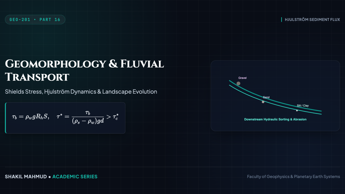
Geomorphology is the quantitative study of planetary surface landforms, examining the dynamic interplay between tectonic uplift, rock lithology, and climate-driven erosional processes. Surface denudation is mediated by three primary fluid transport agents: fluvial networks sculpting river valleys, glaciers carving U-shaped troughs, and ocean waves eroding coastal interfaces. These systems obey rigorous hydrodynamic equations of shear stress, fluid drag, and sediment transport flux.
1. Fluvial Sediment Transport: The Shields Parameter and Hjulström Dynamics
River flow exerts a basal boundary shear stress ( au_b) on riverbed sediments proportional to hydraulic radius (R_h) and channel energy slope (S):
[
au_b =
ho_w g R_h S
]
Sediment grains of diameter (d) initiate motion when the hydrodynamic fluid drag and lift forces exceed the submerged gravitational resisting force. This mechanical threshold is defined by the dimensionless Shields Parameter (( heta^*) or ( au^*)):
[
heta^* = rac{ au_b}{(
ho_s –
ho_w) g d}
]
where (
ho_s approx 2650 ext{ kg/m}^3) is quartz sediment density and (
ho_w = 1000 ext{ kg/m}^3). Grain movement begins when ( heta^*) exceeds the critical threshold ( heta_c^* approx 0.03 ext{–}0.06) (the Shields curve).
Bedload vs. Suspended Load
- Bedload Flux ((q_b)): Coarse grains rolling and saltating along the bed, modeled by the Meyer-Peter and Müller empirical relation:
[
q_b = 8 sqrt{(
ho_s/
ho_w – 1) g d^3} ( heta^* – heta_c^*)^{3/2}
] - Suspended Load: Fine silts and clays lifted into the water column when upward turbulent turbulent eddies exceed grain settling velocity (w_s) (governed by the Rouse number (Z = w_s / kappa u_*)).
The celebrated Hjulström diagram captures this non-linear behavior: fine sands ((sim 0.2 ext{–}0.5 ext{ mm})) erode at the lowest velocities ((sim 0.2 ext{ m/s})), whereas cohesive clays require high erosional velocities due to electrostatic cohesion, yet remain suspended at near-zero velocities.
2. Glacial Dynamics: Glen’s Flow Law and Basal Sliding
Glaciers deform plastically under gravity as polycrystalline ice undergoes solid-state creep. The strain rate of ice (dot{psilon}) obeys Glen’s Flow Law (a power-law fluid with (n approx 3)):
[
dot{psilon}_{xz} = A au_{xz}^n
]
where (A(T)) is an Arrhenius temperature-dependent rate factor. Integrating shear stress ( au_{xz}(z) =
ho_i g (H – z) sinalpha) from the bedrock ((z=0)) to surface ((z=H)) gives the surface velocity due to internal deformation:
[
u_{ ext{def}}(H) = rac{2 A}{n + 1} (
ho_i g sinalpha)^n H^{n+1}
]
In temperate glaciers where basal ice reaches the pressure-melting point ((T = T_{ ext{pmp}})), pressurized basal subglacial meltwater decouples ice from bedrock, enabling rapid basal sliding via cavitation and regelation, accelerating ice streams to speeds exceeding kilometers per year.
3. Coastal Dynamics: Wave Energy Flux and Rocky Cliff Retreat
Oceanic wave dynamics dictate coastal geomorphic evolution. Deep-water surface gravity waves transmit energy flux (wave power per unit crest width (P_w)):
[
P_w = E c_g = left( rac{1}{8}
ho_w g H_s^2
ight) left( rac{g T}{4pi}
ight) = rac{
ho_w g^2}{32pi} H_s^2 T
]
where (H_s) is significant wave height and (T) is wave period. As waves shoal into shallow coastal waters, wave refraction focuses energy onto headlands via wave ray convergence, driving mechanical cliff retreat via hydraulic quarrying, wave hammer impacts ((P > 10^5 ext{ Pa})), and basal notch undercutting, carving shore platforms, sea arches, and stacks.
4. Landscape Evolution Modeling: The Stream Power Incision Law
On planetary scales, the long-term vertical incision rate of river channels into bedrock (E = partial z / partial t) is parameterized by the Stream Power Law:
[
rac{partial z}{partial t} = U – K A^m S^n
]
where (U) is tectonic uplift rate, (A) is upstream drainage basin area (a proxy for discharge (Q propto A^m)), (S = |
abla z|) is local channel slope, and (K) is bedrock erodibility. In dynamic steady state ((partial z / partial t = 0)), channel slope scales inversely with drainage area: (S = (U/K)^{1/n} A^{-m/n} = k_s A^{- heta}), defining the classic concavity index ( heta approx 0.4 ext{–}0.6) observed across mature global river catchments.